The name Shili carries a quiet sense of mystery.
The character 「嵵」 is nearly impossible to type using modern phonetic input, rarely appears in contemporary language, and cannot even be found in the Kangxi Dictionary. It exists almost exclusively in this place — a symbol belonging only to Shili.
So where did this unusual name come from?
A Name Shaped by the Land
During the Kangxi period of the Qing dynasty, this area was known as Chan'an Ao (禪垵澳) or Zhinei (峙內), likely encompassing what is now Jing'an. By the Qianlong era, the name gradually evolved into Shili Ao (嵵裡澳) or Shili She (嵵裡社).
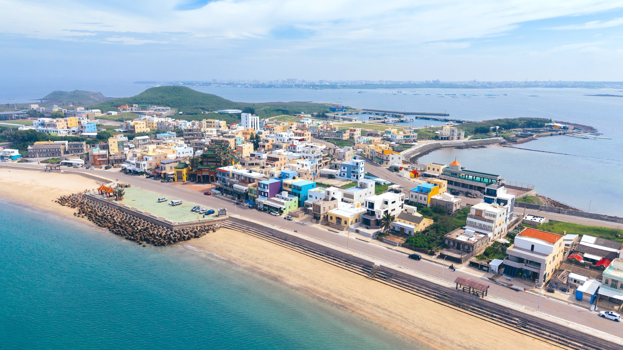
According to local elders, a mountain to the north of the village resembles the official hat worn by Qing dynasty officials, and was thus named Shamao Mountain (紗帽山). The surrounding terrain extends outward like the side flaps of the hat, forming a shape similar to a spoon. This formation came to be known as Shamao Shi (紗帽嵵), or Spoon Mountain.
The settlement lies within this formation, giving rise to the names Shinei (嵵內) and later Shili (嵵裡).
In this way, the name "Shili" is deeply rooted in the landscape — a reflection of how early inhabitants observed and interpreted their natural surroundings.
As for the character 「嵵」 itself, it likely originated from the mountain's name, and continued to be used even during the Japanese colonial period.
Settlement and Family Roots
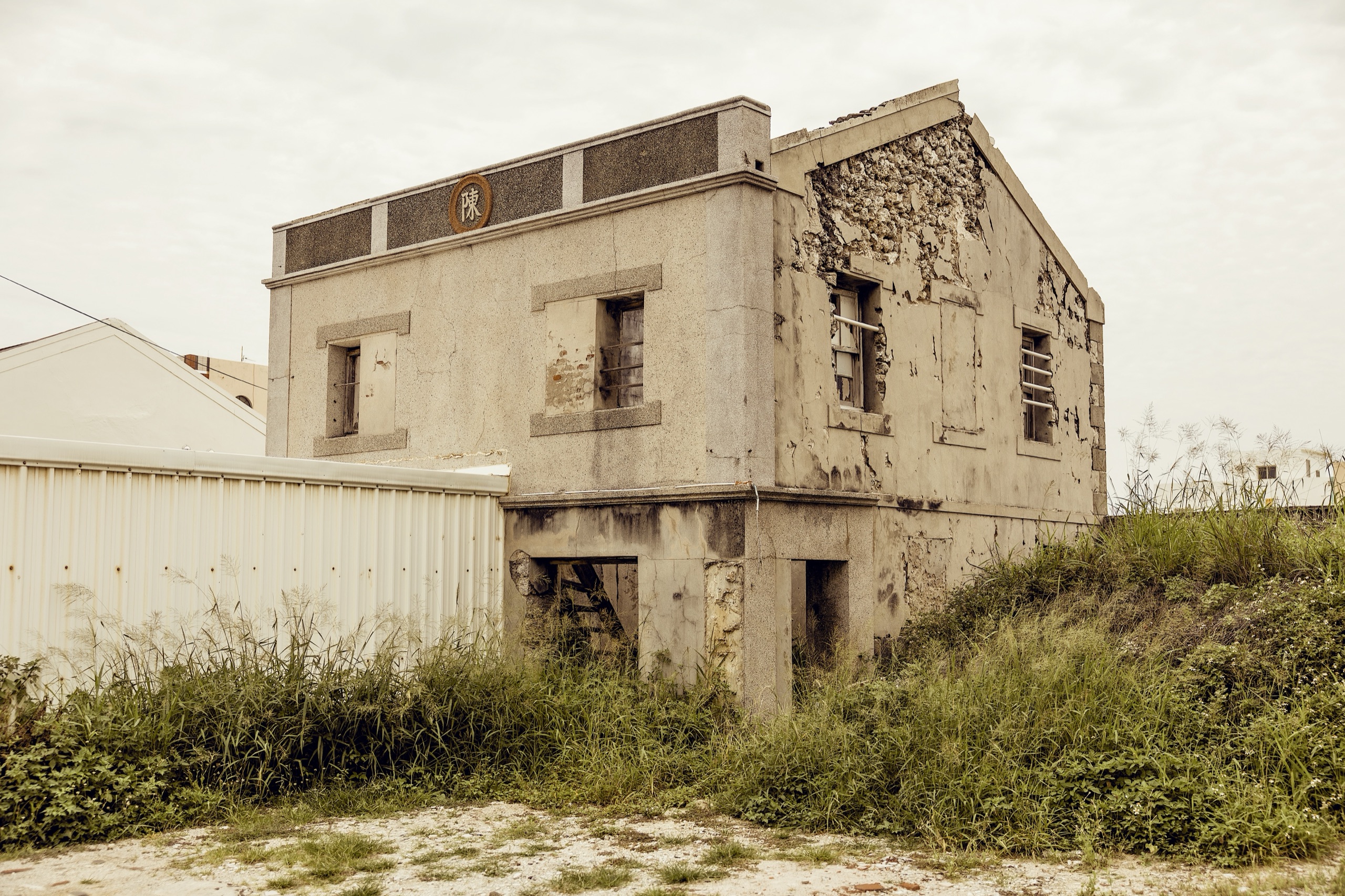
Shili has long been centered around the Chen family, the village's largest clan. Their ancestors migrated from mainland China to Kinmen, settling in Shuitou, before crossing the sea to Penghu. They have lived here for over 300 years, spanning more than thirteen generations.
Another key family, the Wu clan, arrived during the Kangxi period from Lesser Kinmen. Initially without an ancestral hall, one was later established through the efforts of Wu Deming, and completed in 1989.
Historical records, including the Penghu Gazetteer (Penghu Jilüe), confirm that during the Qing dynasty, Shili was already recognized as a named settlement under the jurisdiction of Shili Ao.
These layers of documentation and oral history form the foundation of the village's identity.
Living with the Sea
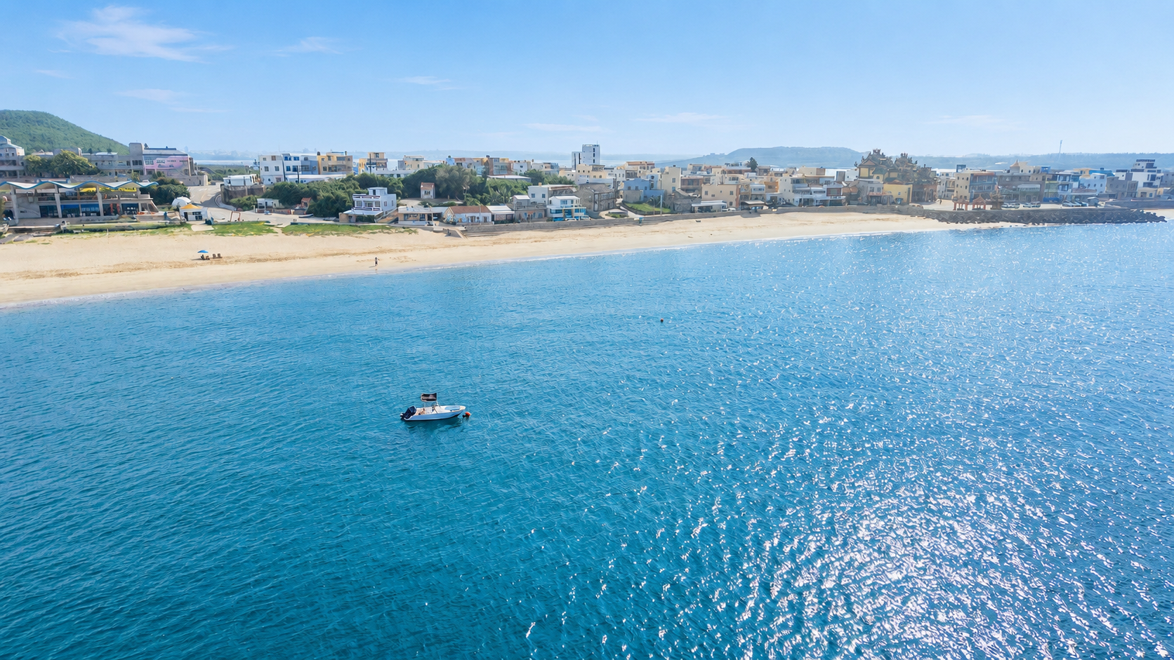
Shili's geography is long from east to west and narrow from north to south, with the land gently sloping from northwest to southeast.
To the north lies the inner bay of Magong, characterized by rocky shores, while the south opens to the Taiwan Strait, where a stretch of white shell beach lines the coast.
For generations, life here has been shaped by the sea.
Fishing was the primary livelihood, with methods such as stone weir fishing (shihu), beach seine nets, and various coastal techniques. The Chen family's stone weirs in the Houbi area, for instance, once covered an extensive area.
According to a 1917 survey (Taisho 6), Shili had 102 households and a population of 572. Of these, 204 were engaged in fishing, supported by 26 boats, mainly used for trawl net fishing and line fishing.
Women often contributed through small-scale farming, seafood processing, and net mending, forming a way of life closely intertwined with the rhythms of the sea.
Changing Industries and Times
Agricultural land in Shili has always been limited, mostly confined to small household gardens.
Over time, farming gradually declined, and by around 1976, most agricultural activity had ceased.
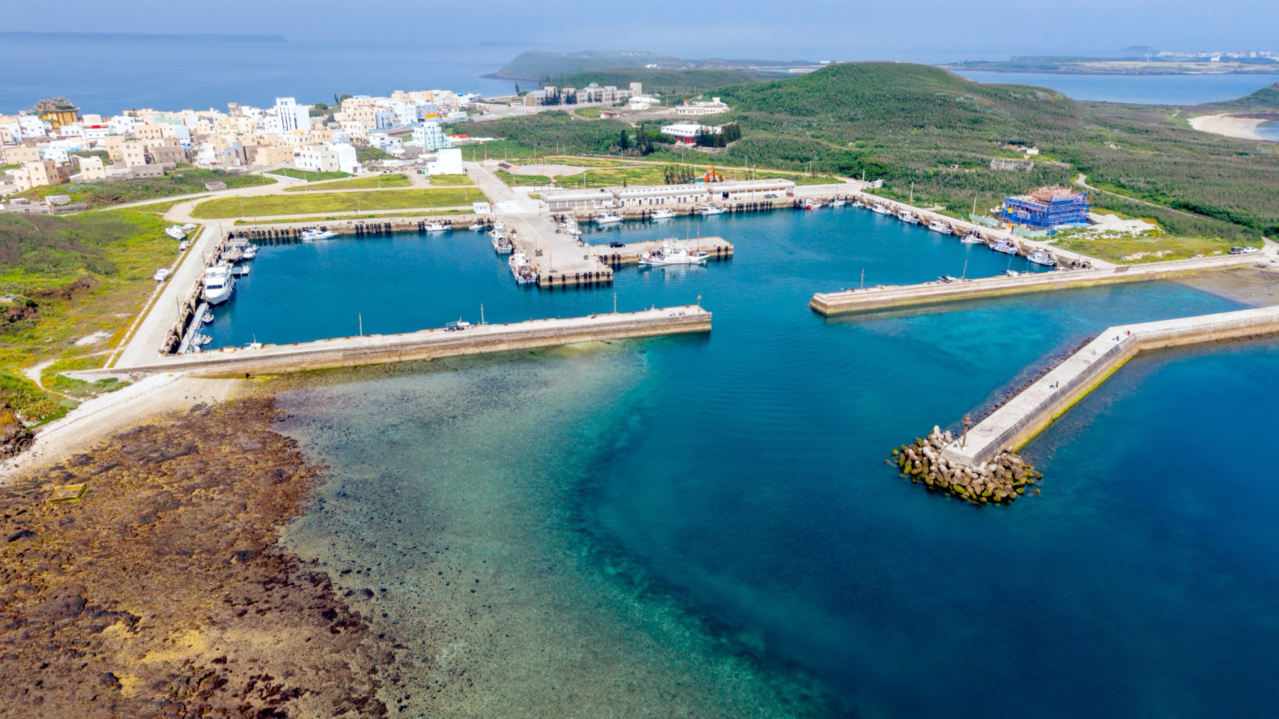
Fishing, however, continued to develop. Beginning in the 1950s, motorized fishing boats became more common, and by the 1970s, over 50 vessels were in operation, primarily catching sardines and squid.
By the 1990s, boat capacities had increased significantly, with some reaching up to 500 horsepower. Fishing methods expanded to include trawling, longlining, and drift netting, reflecting the village's evolving relationship with the sea.
Landscape and Modern Traces
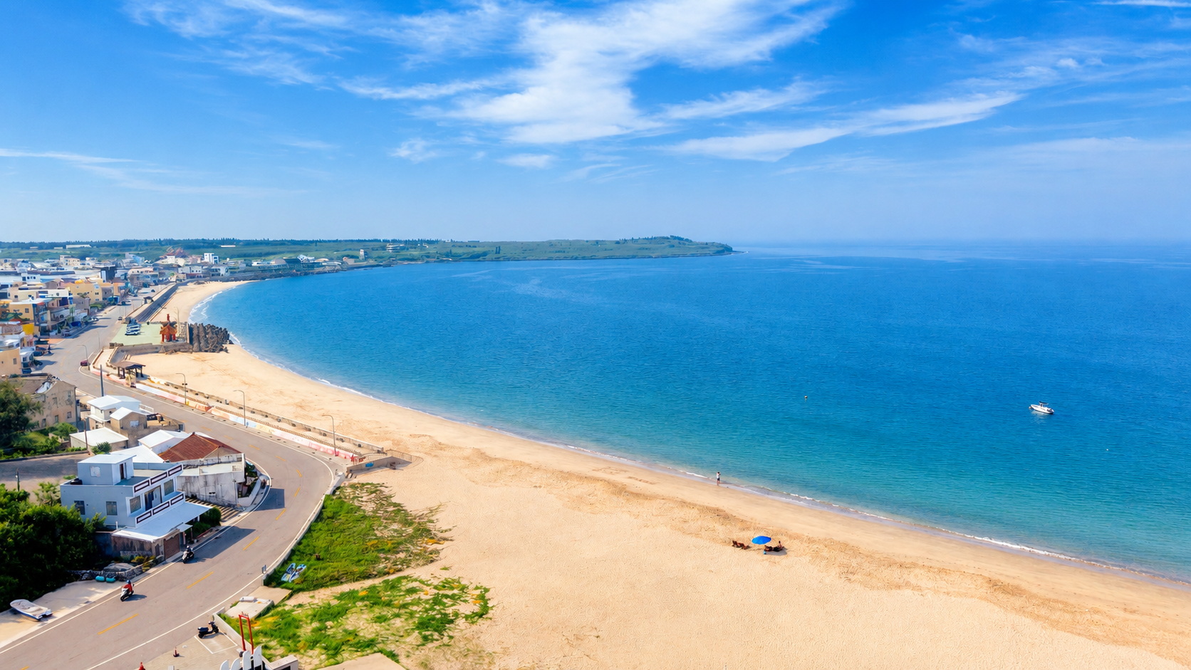
The southern shoreline of Shili, now known for its beach, was once a vital working area for traditional fishing methods such as beach seining.
In 1966, the government established Shili Beach as a public swimming area, and by the 1970s it had become one of Penghu's key coastal destinations.
Around the village, traces of different historical periods remain: waters once used as a training ground for the Marine Corps, a small pier built during the Japanese era (locally known as Nanwan Bridge), and roads and seawalls constructed in the postwar years.
Off the eastern coast, shallow waters are home to rare endemic coral species, and in 2004, the area was designated as a protected fishery zone.
「嵵裡」這個地名,本身就帶著一種神秘感。
「嵵」字在注音輸入法中難以輸入,在現代用語中也幾乎沒有其他使用場景,甚至不見於《康熙字典》。它幾乎只存在於這個地方,成為一個專屬於嵵裡的符號。
那麼,這個特別的名字是如何來的呢?
從地形而來的名字
嵵裡在清康熙時期曾被稱為「禪垵澳」或「峙內」,其範圍可能還包含今日的井垵一帶。到了乾隆之後,逐漸改稱為「嵵裡澳」或「嵵裡社」。
根據地方耆老的口述,聚落北邊有一座山,外形像清朝官員所戴的紗帽,因此被稱為「紗帽山」。而這座山延伸出的地形,如同紗帽兩側的冠耳,其輪廓又像一把「匙」,於是被稱為「紗帽嵵」或「匙山」。
聚落正好位於這片山形之內,因此有了「嵵內」或「嵵裡」的名稱。
由此可見,「嵵裡」這個名字,其實來自人們對自然地形的觀察與想像,是一種與環境緊密相連的命名方式。
至於「嵵」這個字的寫法,可能也是因山名而生,日治時期仍沿用「嵵裡」作為地名。
聚落的形成與家族記憶
嵵裡以陳姓為主要大族。據記載,陳姓祖先自大陸遷至金門水頭,之後再渡海來到澎湖,在此定居,至今已有三百餘年的歷史,傳承超過十三代。
另一個重要家族為吳姓,於清康熙年間自小金門遷入。最初並無家廟,後由吳德明發起興建,於民國 78 年(1989 年)落成。
根據《澎湖紀略》記載,清領時期此地已以「嵵裡」為社名,隸屬於嵵裡澳。這些歷史記錄與家族記憶,構成了嵵裡聚落發展的重要基礎。
與海共生的生活
嵵裡地形東西狹長、南北較窄,地勢由西北向東南緩緩傾斜。北側面向馬公內海,多為岩岸地形;南側則臨台灣海峽,有一片潔白的貝殼沙灘。
早期居民的生活以海為主,依靠石滬捕魚、牽罟與各式漁法維生。例如陳姓家族在後壁滬一帶的石滬規模相當廣大。
根據大正 6 年(1917 年)的調查,當時嵵裡共有 102 戶、572 人,其中漁民就有 204 人,並擁有 26 艘漁船,多從事船曳網與一支釣。
女性則多從事簡單農作、水產加工與補網等工作,形成一種與海密切連結的生活方式。
產業與時代的變化
嵵裡的耕地原本就不多,主要集中於住家周邊的小型菜園。隨著時代變遷,農業逐漸式微,至民國 65 年(1976 年)後,多數農地已不再耕作。
相對地,漁業逐漸發展。自民國 41 年(1952 年)起,動力漁船開始增加,到 1970 年代已有 50 餘艘,以捕撈鰮魚與小管為主。
1990 年代之後,漁船馬力提升,部分船隻甚至達到 500 匹馬力,發展出拖網、延繩釣與流刺網等漁業型態。
地景與現代發展
嵵裡南側的沙灘,過去是居民進行牽罟作業的重要場域。民國 55 年(1966 年),政府在此設立「嵵裡海水浴場」,1970 年代後逐漸發展為澎湖的重要觀光景點之一。
此外,嵵裡周邊也保留了不同時期的痕跡:曾為海軍陸戰隊訓練基地的海域、日治時期的運補碼頭(南灣橋)、以及戰後拓建的道路與海堤。東側海域亦分布著澎湖特有的珊瑚群,並於 2004 年被劃設為漁業保護區。